A
B
C
D
Text Solution
Verified by Experts
The correct Answer is:


Topper's Solved these Questions
QUESTION BANK 2021
CBSE MODEL PAPER|Exercise AREAS RELATED TO CIRCLES (Case Study 3)|5 VideosQUESTION BANK 2021
CBSE MODEL PAPER|Exercise A BROOCH (Case Study 4) |5 VideosQUESTION BANK 2021
CBSE MODEL PAPER|Exercise SOME APPLICATION OF TRIGONOMETRY (Case Study 1)|5 VideosPRACTICE PAPER 2022
CBSE MODEL PAPER|Exercise Multiple Choice Questions|60 VideosSAMPLE PAPER (MATHEMATICS STANDARD)
CBSE MODEL PAPER|Exercise PART - B|16 Videos
Similar Questions
Explore conceptually related problems
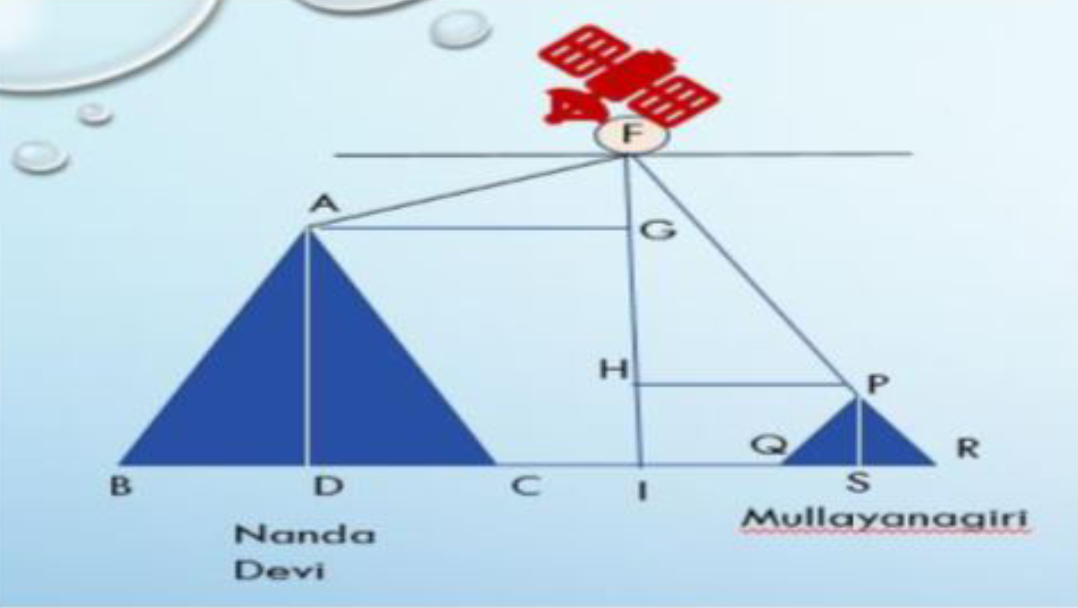
CBSE MODEL PAPER-QUESTION BANK 2021-SOME APPLICATION OF TRIGONOMETRY(Case Study 2)
- A Satellite flying at height h is watching the top of the two tallest ...
Text Solution
|
- A Satellite flying at height h is watching the top of the two tallest ...
Text Solution
|
- A Satellite flying at height h is watching the top of the two tallest ...
Text Solution
|
- A Satellite flying at height h is watching the top of the two tallest ...
Text Solution
|
- A Satellite flying at height h is watching the top of the two tallest ...
Text Solution
|