A
B
C
D
Text Solution
Verified by Experts


Topper's Solved these Questions
Similar Questions
Explore conceptually related problems
X BOARDS-QUESTION PAPER 2022 TERM 1 SET 2 BASIC-SECTION C (Case Study Based Question)
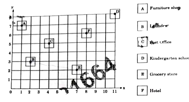
- A rough co-ordinate map of Lahiri's locality is shown below : Th...
Text Solution
|
- A rough co-ordinate map of Lahiri's locality is shown below : Th...
Text Solution
|
- A rough co-ordinate map of Lahiri's locality is shown below : If...
Text Solution
|
- A rough co-ordinate map of Lahiri's locality is shown below : An...
Text Solution
|
- A rough co-ordinate map of Lahiri's locality is shown below : Th...
Text Solution
|
- Pookalam is the flower bed or flower pattern designed during Onam in K...
Text Solution
|
- Pookalam is the flower bed or flower pattern designed during Onam in ...
Text Solution
|
- Pookalam is the flower bed or flower pattern designed during Onam in K...
Text Solution
|
- Pookalam is the flower bed or flower pattern designed during Onam in K...
Text Solution
|
- Pookalam is the flower bed or flower pattern designed during Onam in K...
Text Solution
|